12 August 2019
Over the past four years we have been undertaking significant new R&D in property location and hazard risk analytics with cloud computing. In particular, we have developed an organic set of products based on three new technologies (Web APIs, Web Apps and Web Maps) to support two cloud-based geospatial big data and analytics platforms for property location and hazard risk intelligence:
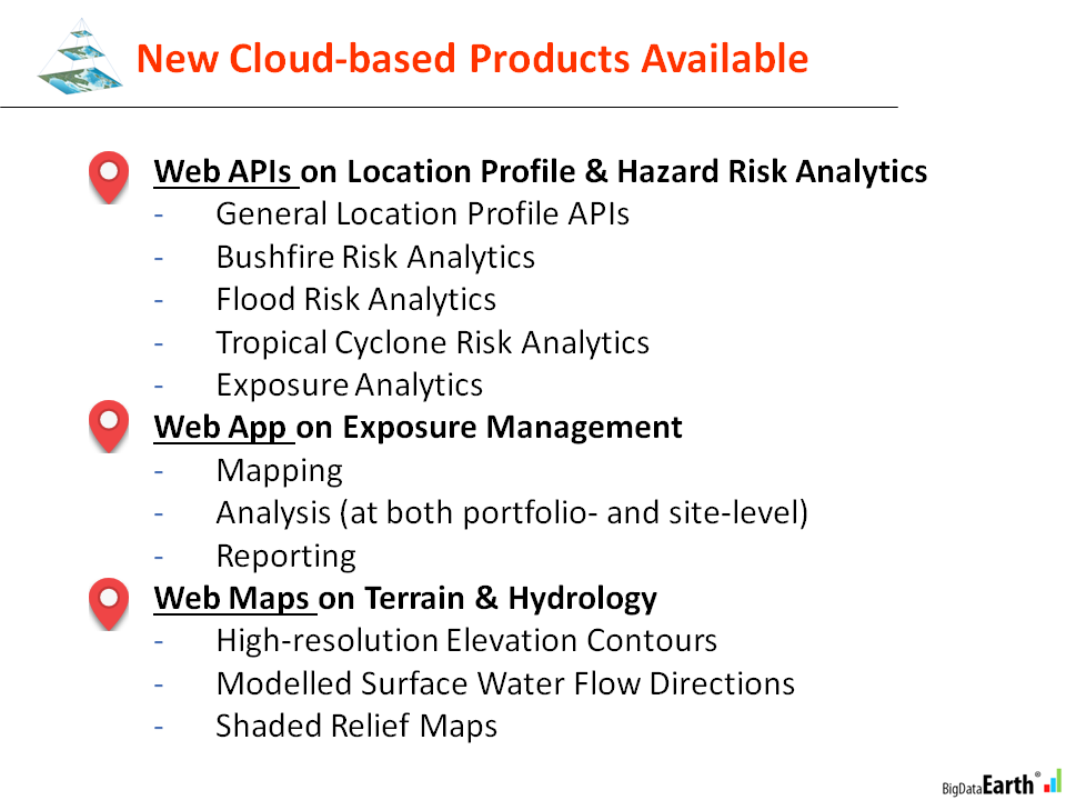
A range of new products are created at scale with heavy use of automation and optimisation. We have prepared a 27-page PowerPoint file (link, 5.1 MB) to showcase some of the major cloud-based products currently available (Figure 1).
Figure 1: New cloud-based products based on Web APIs, Web App and Web Maps
It’s been transformative from desktop computing to fully embracing cloud computing. New opportunities for more powerful and efficient property location and hazard risk analytics are enabled by cloud computing.
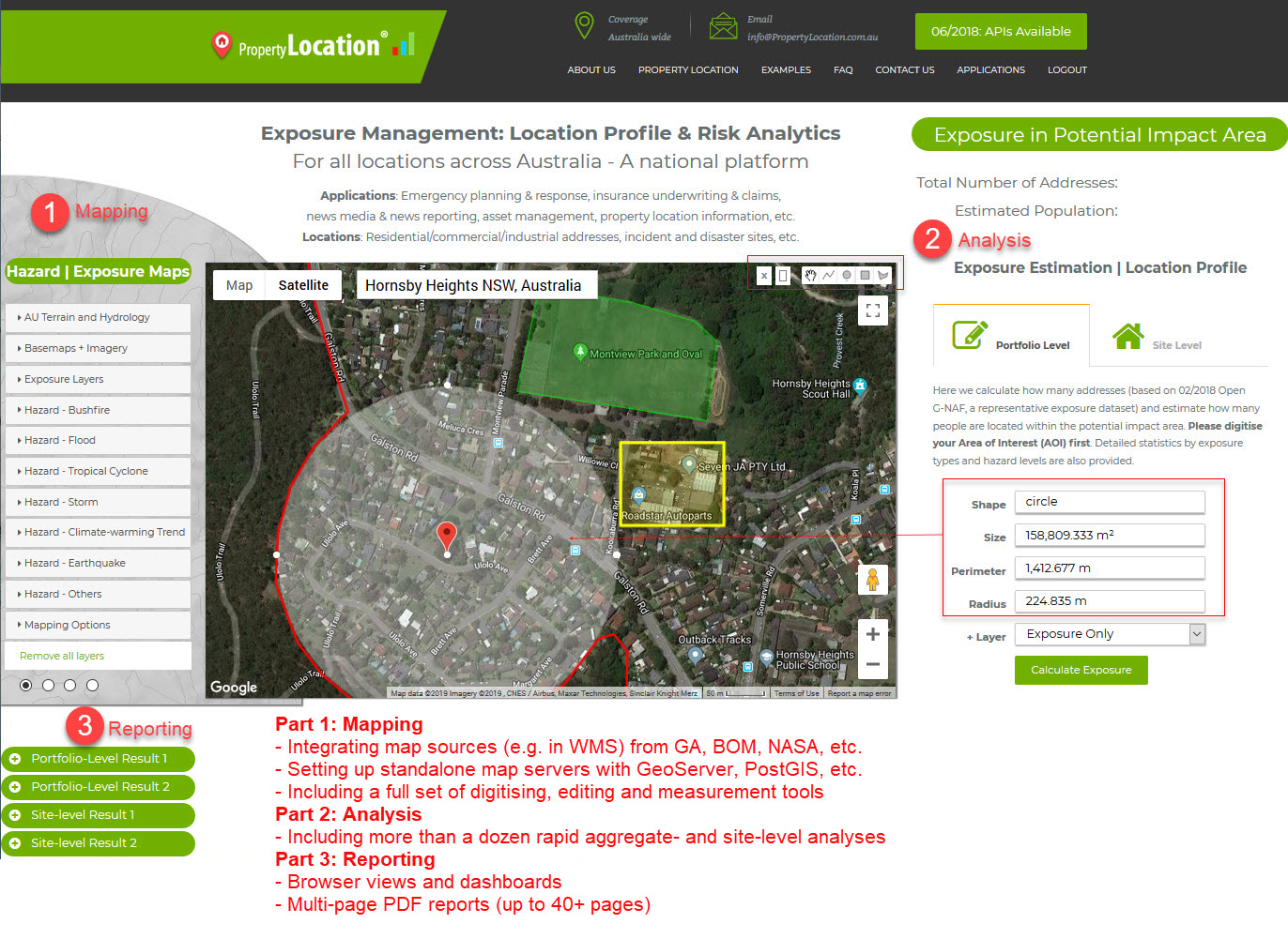
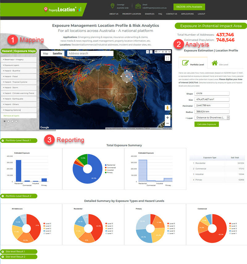
One of the major products is a Web App on exposure management, which features three key functions of mapping, analysis and reporting altogether (Figures 2 and 3), specifically:
-
Integration of map sources (e.g. in WMS) from GA, BOM, NASA, etc.
-
Setup of standalone map servers with GeoServer, PostGIS, etc.
-
A full set of digitising, editing and measurement tools
-
More than a dozen rapid exposure analyses (at both aggregate- and site-level)
-
Various forms of reporting (dashboards, PDF, animations, etc.) on the fly
After four years of active R&D, a milestone has been reached in terms of technologies and products development. We are now seeking broad client interests and extending our R&D experience for new and innovative applications in Australia and overseas.

Figure 2: A new Web App featuring three key functions: mapping, analysis and reporting
Figure 3: A new Web App featuring three key functions: mapping, analysis and reporting


