AI Applications: Geocoding, Property Location Metrics
& Hazard Risk Modelling

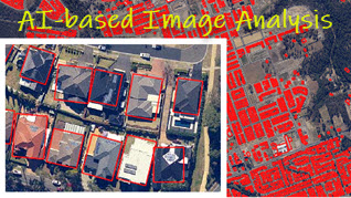
Extracting Features from High-resolution Imagery: An AI-based Processing Service

  • Processing workflow and key components

  • Some observations and critical views about this type of image analysis

  • Creating AI-based analysis and applications for property location metrics and hazard risk modelling

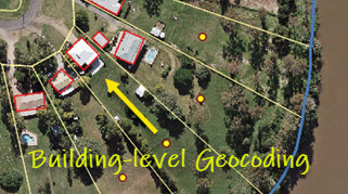
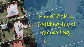
Building-level Geocoding of G-NAF (address database) for Improved Flood & Bushfire Risk Analysis in Australia

  • Comparison between parcel-level and building-level geocoding

  • Geocoding differences in the context of flood and bushfire risk analysis

  • Building-level geocoding of G-NAF address points for most flood- and bushfire-prone regions in Australia

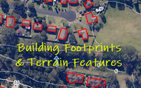
Creating Building Footprints and Terrain Features for Web and Desktop Mapping: With Examples from the NSW Coast

  • Extraction of building footprints for coastal stretches in Newcastle and Wollongong, NSW

  • Terrain features including contours and modelled surface water flow directions

  • All feature layers ready for both web and desktop mapping

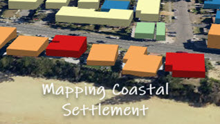
Mapping the Coastal Settlement in Wamberal, NSW: Two Approaches

  • LiDAR-based Geospatial Approach

  • Imagery-based AI Approach

Building-level Geocoding for Regional Flood Risk Analysis: A Case Study in Ipswich, Queensland

  • At a regional or catchment level, flood risk analysis is sensitive to the exposure data geocoded by different methods.

  • The use of building-level geocoding can produce more objective exposure estimation.

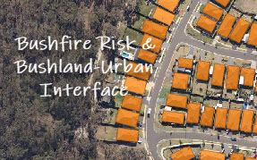
Monitoring Land Cover Changes at the Bushland-Urban Interface: An Image Analysis Approach

  • Image-based analysis provides a cost-effective solution.

  • Mapping bushland using new imagery

  • Mapping buildings and new developments at the bushland-urban interface