Knowledge- and Data-driven Geospatial Big Data Analytics
Main Analysis and Modelling Techniques We Use
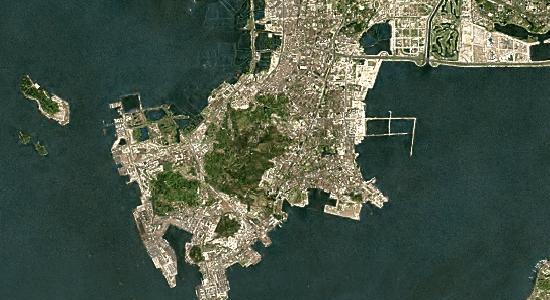
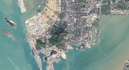
Rapid urban expansion shown by Landsat-7 (Left) / Landsat-8 (Right) imagery between 2000-2015. Location: Shenzhen – Hong Kong border, China.
Advanced Image Processing and Feature Extraction
- Object- and pixel-based image classification
- Orthorectification, image fusion, image enhancement, computer vision techniques
- Land covers change detection and trend analysis
- Pre- and post-event site profiling and investigation
- Analysing short-wave and/or thermal infrared bands (e.g. from Himawari 8/9, GOES 16/17, Sentinel-2, Landsat-8, WorldView-3 imagery)
- Making large-sized imagery mosaics (e.g. up to multiple terabytes in file sizes)
Geospatial processing service: Turn your high-resolution imagery into feature layers link
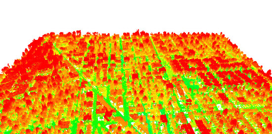
Suburban buildings and vegetation shown by the USGS LiDAR data captured in 2014. Location: New York City, the U.S.
Terrain and Geomorphological Modelling
Digital Elevation Model (DEM), Digital Surface Model (DSM) and Digital Terrain Model (DTM) generation; Contours generation
- Processing large-sized LiDAR Point Clouds (e.g. DEM generation, ground feature extraction)
- Developing geomorphological metrics for terrain characterisation and quantification
- Making large-sized elevation and shaded-relief mosaics (e.g. up to multiple terabytes in file sizes)
Geospatial processing service: Turn your high-resolution DEMs into feature layers link
GIS, Mapping and Visualisation
- Mainstream GIS geospatial analyses (both raster- and vector-based)
- Development and customisation of geospatial algorithms
- Advanced spatial interpolations and geocoding (e.g. adaptive and context-aware)
Spatial data management (e.g. through PostGIS/MySQL/Microsoft SQL Server spatial databases, ESRI Geodatabase, GCP BigQuery & Cloud SQL)
- 2D/3D web mapping (e.g. with XYZ/Google/Bing/ESRI/OSM/MapBox/CartoDB tilesets), time-series visualisation, geospatial web services
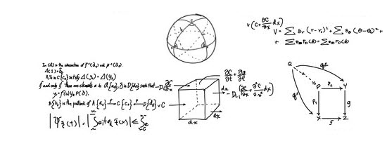
Applied Maths
- Probability and statistics, extreme value distributions and analysis, curve fitting
- Operations research, linear programming, multi-criteria evaluation and decision support, optimisation
- Spatio-temporal geostatistical modelling, spatial uncertainty analysis
- Wavelet transformation in image analysis and geoscience
- Numerical methods (e.g. approximation and finite difference methods)
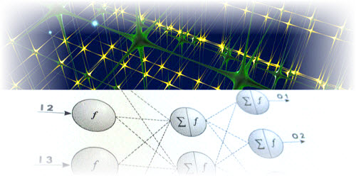
Artificial Intelligence, Machine Learning and Predictive Analytics
- Applications of both supervised and unsupervised learning methods
- Applications of artificial neural networks and machine learning (especially the latest deep learning) for image classification and feature extraction
- Comparison between machine learning methods and conventional statistical methods in time-series prediction
- Comparison of various clustering techniques and cluster analyses
- Applications of data mining and knowledge discovery in databases (KDD) techniques
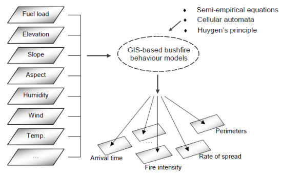
Environmental/Geophysical Modelling and Simulation
- Modelling environmental degradation and impact (e.g. air/water/soil pollution)
- Deterministic “what-if” scenario analysis (e.g. for physical and socioeconomic attributes)
- Monte Carlo stochastic simulation (e.g. for physical environmental attributes)
- Earth Systems modelling (e.g. for climate change impact, population dynamics, biodiversity, land cover change and sustainability)
- Model comparisons and critical evaluation
- Model development, computer programming and software release