29 01, 2021

Data & Analytics Services in Response to Major Events: New Case Studies

2021-01-30T11:17:42+11:00January 29th, 2021|APIs, Asia, Australia, Bushfire, Earth Observation, Emergency, Exposure, Geospatial Big Data Analytics, Image Analysis, Location Intelligence, Major Events, News Media, Risk, Tropical Cyclone, USA|

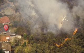
We offer data & analytics services to aid rapid response to major events, such as disasters and emergencies. In this blog, we showcase our efforts in response to a number of major events in Australia during the summer week of 20-26 January 2021. A range of information products related to a tropical low, [...]

24 11, 2020

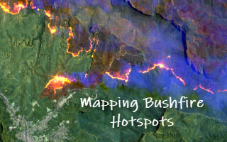
Detecting Bushfire Hotspots from Himawari-8 Imagery: With Four Examples from the 2019-20 Australian Bushfire Season

2021-01-11T22:18:53+11:00November 24th, 2020|AI, APIs, Apps, Asset Management, Australia, Bushfire, Climate Change, Cloud Computing, Earth Observation, Emergency, Geospatial Big Data Analytics, Image Analysis, Location Intelligence, Major Events, News Media, Risk, Sentinel-2|

The new generation of geostationary meteorological satellites, such as Himawari-8 from the Japan Meteorological Agency (JMA, link), offer much improved capabilities of monitoring large-scale weather events in the atmosphere and phenomena on the Earth's surface. Himawari-8 sensors (Advanced Himawari Imagers - AHIs) are equipped with 16 spectral bands: 3 visible bands at 0.5 [...]

2 04, 2020

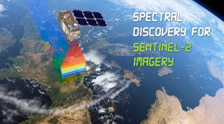
Unique Software Spectral Discovery to Easily and Rapidly Process Sentinel-2 Imagery

2021-01-13T18:26:09+11:00April 2nd, 2020|Agriculture, Asia, Australia, Bushfire, Earth Observation, Emergency, Image Analysis, Major Events, News Media, Risk, Sentinel-2, USA, Wildfire|

2 April 2020 Sentinel-2 (with twin satellites Sentinel-2A and Sentinel-2B) is one of the most successful Earth observation missions from the EU Copernicus Programme and ESA. Sentinel-2 satellite imagery features: wide swath (290km) multiple spectral bands (13 bands) high resolution (four visible and near-infrared bands at 10m, six red-edge/shortwave-infrared bands at 20m, and three [...]

31 08, 2018

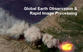
Monitoring Major Events with Global Earth Observation and Geospatial Big Data Analytics: 10+ New Examples

2020-10-03T00:49:18+10:00August 31st, 2018|Asia, Australia, Bushfire, Earth Observation, Emergency, Image Analysis, Major Events, News Media, Risk, Sentinel-2, USA, Wildfire|

31 August 2018 This blog summarises some of our latest activities of monitoring, modelling and mapping major hazardous events with Earth observation and geospatial big data analytics, the two methods that are increasingly important and indispensable for a wide range of environmental studies. We routinely apply our own advanced image analysis software (Spectral Discovery) [...]

25 10, 2017

Visualising Potential Bushfire Risk for Addresses in Australia: A New Cloud-based Approach

2020-10-03T00:49:24+10:00October 25th, 2017|Australia, Bushfire, Earth Observation, Location Intelligence, News Media, Property Information, Risk|

25 October 2017 It's well known that hundreds of thousands of Australian properties (e.g. residential, commercial and industrial) at the urban-bushland interface are very prone to damaging bushfires. Increasing population, urban encroachment into bushland and a dangerous warming climate all suggest that bushfire risk is on the increase. Bushfire risk assessment has been a [...]

16 10, 2017

Some Imagery Sources for the Northern California Wildfires in October 2017

2020-10-03T00:49:25+10:00October 16th, 2017|Earth Observation, Location Intelligence, Major Events, News Media, USA, Wildfire|

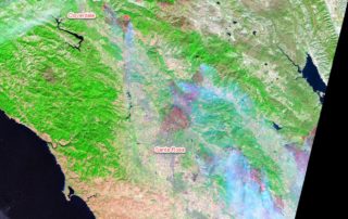
16 October 2017 The catastrophic wildfires in Northern California started a week ago have claimed at least 40 lives and destroyed nearly 6,000 buildings (news report). The fires continuously burning over the past week and the extensive damage have been observed by low-, medium- and high-resolution satellite imagery. Here we summarise and analyse a few useful imagery sources. [...]

28 08, 2017

News Release: BigData Earth Offers Cloud-based Rapid LOCATION Analytics For The News Media Worldwide

2021-01-13T13:13:00+11:00August 28th, 2017|Asia, Australia, Earth Observation, Location Intelligence, Major Events, News Media, Risk, USA|

Location information is critical for news reporting, especially in the event of emergencies, natural disasters, industrial pollution, etc. Relevant location information and insights can not only make the news story more detailed and interesting, but also help readers understand each event and its context more quickly. BigData Earth has been developing unique location [...]

Go to Top