31 August 2018
We are pleased to release property/exposure Location Profile APIs (Version 2.0), out of beta! (Link to an initial release and introduction is here.) More than ten APIs are currently available for property location and hazard risk intelligence.
Main applications: Property location information, emergency planning and response, insurance underwriting and claims, news media and reporting, etc.
Geographic coverage: Australia, the Contiguous US and the rest of the world (with varying levels of details in input and output across regions).
BigData Earth’s Developer Portal (https://bigdataearth.developer.azure-api.net/) provides all details about how to test and deploy those APIs.
API Deployment
As we introduced previously, the Location Profile APIs have enabled the development of our two property location and hazard risk information portals:
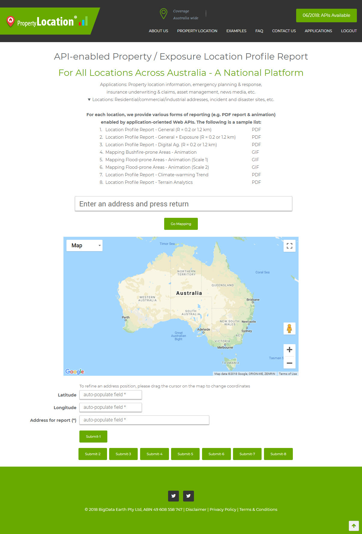
The implementation of a full range of APIs at the above two portals can be seen in Figures 1 and 2 below. In these cases, users just need to pass on simple location information (i.e. latitude and longitude) and click a button to submit a corresponding API request and obtain results (in the form of PDF report, animation, etc.) in seconds.
In fact, there are many convenient ways to deploy and run APIs; the Developer Portal provides various code samples. A third-party use of APIs for web applications typically involves some server-side scripting (e.g. PHP) and client-side scripting (e.g. JavaScript). We are happy to provide any assistance if needed.
We are continuously developing more application-oriented Location Profile APIs for Australia, the U.S. and worldwide sites. Two new APIs – one on historical weather and the other on historical cyclone tracks – are planned to be released within next few months. So please stay tuned.
Figure 1: Implementation of a range of Location Profile APIs at https://PropertyLocation.com.au/
Figure 2: Implementation of a range of Location Profile APIs at https://PropertyLocation360.com/