18 06, 2018

New Methods and Tools (Web APIs) for Innovative Exposure Analytics

2021-01-13T12:58:39+11:00June 18th, 2018|APIs, Asia, Asset Management, Australia, Exposure, Geospatial Big Data Analytics, Insurance, Location Intelligence, Major Events, Risk|

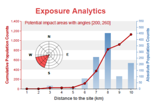
18 June 2018 Almost every industry has some types of exposure data, and its data quality and analysis are crucial for overall exposure management and decision making. For the businesses dealing with environmental, industrial, technological and man-made hazards and risk, the spatial and temporal accuracy of the underlying exposure data is among the most important. [...]

8 06, 2018

Introducing Location Profile APIs for Property Location and Hazard Risk Intelligence

2020-10-03T00:49:23+10:00June 8th, 2018|APIs, Asia, Asset Management, Australia, Exposure, Geospatial Big Data Analytics, Insurance, Location Intelligence, Property Information, Real Estate, Risk, USA|

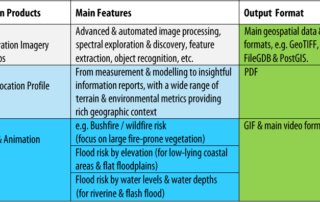
8 June 2018 The public release of BigData Earth's Location Profile APIs is a milestone in our vision of achieving API-first, cloud-based big data analytics and innovative solutions. [Update 31 August 2018: APIs Version 2.0 out of beta] The set of APIs released now reflects our substantial R&D in the following major applications over [...]

15 12, 2017

Progress in 2017: Advancing Emergency and Insurance Applications Using Geospatial Big Data Analytics and Global Earth Observation

2020-10-03T00:49:23+10:00December 15th, 2017|Asia, Australia, Earth Observation, Emergency, Geospatial Big Data Analytics, Insurance, Location Intelligence, Risk|

15 December 2017 Time flies and another year comes to an end. This blog summarises and highlights what we have achieved during 2017. Our vision has been to create innovative location-centric applications using Geospatial Big Data Analytics, Global Earth Observation and Cloud Computing. Location intelligence is becoming ubiquitous and increasingly important for a wide range of [...]

28 08, 2017

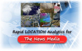
News Release: BigData Earth Offers Cloud-based Rapid LOCATION Analytics For The News Media Worldwide

2021-01-13T13:13:00+11:00August 28th, 2017|Asia, Australia, Earth Observation, Location Intelligence, Major Events, News Media, Risk, USA|

Location information is critical for news reporting, especially in the event of emergencies, natural disasters, industrial pollution, etc. Relevant location information and insights can not only make the news story more detailed and interesting, but also help readers understand each event and its context more quickly. BigData Earth has been developing unique location [...]

26 06, 2017

Developing Exposure LOCATION Profile for International News Reporting: Take the 2017-06-24 Landslide in SW China as an Example

2020-10-03T00:49:35+10:00June 26th, 2017|Asia, Earth Observation, Landslide, Location Intelligence, Major Events, Risk|

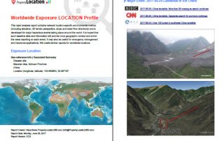
26 June 2017 Location information and insights are becoming ubiquitous and more important than ever. Tangible and easy-to-read location information, mainly through maps and various visualisation techniques, enhances our understanding of many dynamic phenomena. For the current news reporting on major hazardous events taking place around the world, there is a need to include more detailed and coherent [...]

5 12, 2016

BigData Earth Develops New Location Profile Report for Worldwide Agricultural Land

2021-02-04T11:37:39+11:00December 5th, 2016|Agriculture, Asia, Asset Management, Australia, Climate Change, Cloud Computing, Earth Observation, Flood, Geospatial Big Data Analytics, Image Analysis, Location Intelligence, Property Information, USA|

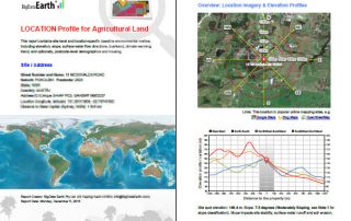
Modern Earth observation technologies (spaceborne, airborne and terrestrial) are increasingly deployed to capture environmental attributes about agricultural land and assets. Geospatial big data collected by various sensors and the information extracted are critical for the growing AgTech and digital agriculture business. Many baseline terrain and environmental metrics for agricultural land should be systematically [...]

Go to Top