27 March 2017
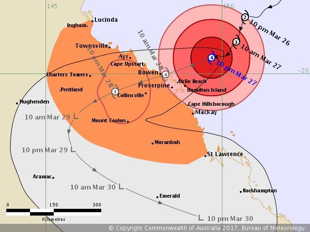
It is forecast that Tropical Cyclone Debbie will cause severe damage to the coastal region spanning from Townsville in the north to Mackay in the south. It will make landfall near Bowen.
Figure 1: Latest track forecast for TC Debbie (Source: BoM)
We use a newly-developed national platform to rapidly produce exposure location profile reports for three coastal sites in the affected region, and share the report with colleagues. Each report provides a range of location metrics that are relevant to emergency management and insurance underwriting, especially for the delineation of low-lying coastal areas vulnerable to storm surges and inundation. Three reports can be downloaded below.

