26 06, 2017

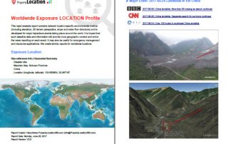
Developing Exposure LOCATION Profile for International News Reporting: Take the 2017-06-24 Landslide in SW China as an Example

2020-10-03T00:49:35+10:00June 26th, 2017|Asia, Earth Observation, Landslide, Location Intelligence, Major Events, Risk|

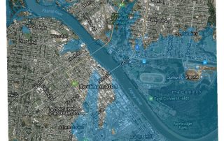
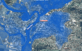
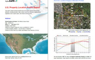
26 June 2017 Location information and insights are becoming ubiquitous and more important than ever. Tangible and easy-to-read location information, mainly through maps and various visualisation techniques, enhances our understanding of many dynamic phenomena. For the current news reporting on major hazardous events taking place around the world, there is a need to include more detailed and coherent [...]

3 04, 2017

Visualising Low-lying Areas in Response to Major Flooding: Case Studies in Rockhampton and Bundaberg, Queensland

2021-01-13T11:54:25+11:00April 3rd, 2017|Australia, Earth Observation, Elevation, Flood, Location Intelligence, Major Events, Risk|

3 April 2017 Last Friday we developed two animations that show estimated flood extents of the major floods in Lismore and Murwillumbah, northern NSW. Today we extend that work and apply the same technique to effectively map and visualise many low-lying, flood-prone areas in Queensland. We choose the following two areas for demonstration: Rockhampton [...]

31 03, 2017

Rapidly Estimating the Flood Extent of Major Floods in Lismore and Murwillumbah on 31 March 2017: Animated Maps Included

2021-01-13T00:47:09+11:00March 31st, 2017|Australia, Earth Observation, Elevation, Flood, Location Intelligence, Major Events, Risk|

Initial release: 31 March 2017 The south-east QLD and northern NSW are often afflicted with widespread flooding caused by the torrential rain typically associated with ex-cyclones, and this time with the remnants of severe Tropical Cyclone Debbie which made landfall on the QLD coast between Bowen and Mackay on 28 March 2017.  Based on [...]

3 11, 2016

BigData Earth Develops New-generation Property Location Information for Addresses in the U.S. and Australia

2020-10-03T00:49:54+10:00November 3rd, 2016|Asset Management, Australia, Climate Change, Earth Observation, Elevation, Location Intelligence, Property Information, Real Estate, Risk, USA|

3 November 2016 For industries such as asset management, real estate and insurance underwriting, the location information of assets (e.g. buildings, infrastructure facilities, and agricultural land) is among the most important. Through deep research and development, BigData Earth creates new-generation property location metrics and insights by integrating various thematic layers (including terrain, land cover, climate change, natural [...]

Go to Top