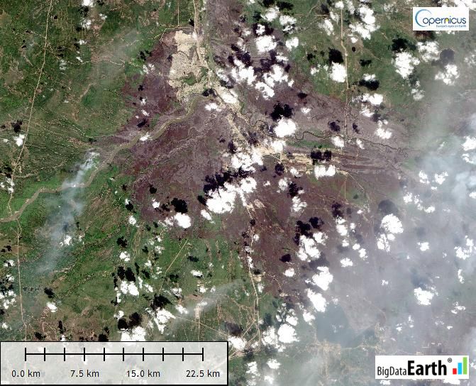
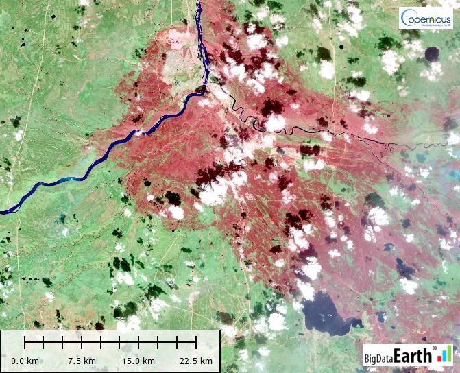
The May 2016 Fort McMurray Wildfire in Alberta, Canada is catastrophic. The fire started on May 1, and as of May 24, is still raging. The fire has destroyed ~2,400 homes and buildings, and resulted in massive fire scars (burnt areas) over 500,000 hectares. It becomes the most expensive nature disaster in Canadian history, with an insurance loss reaching CAN$9 billion and the total economic loss many times greater.
In major and extreme events like this, up-to-date satellite imagery is indispensable for monitoring the propagation of fire fronts, communicating the risk to the public, assessing the damage, and so on. Many imagery providers have shared timely data about this event with the public, and from these one can portray the dynamic nature and the spread of fires effectively. The following animation is sourced from The Globe and Mail.
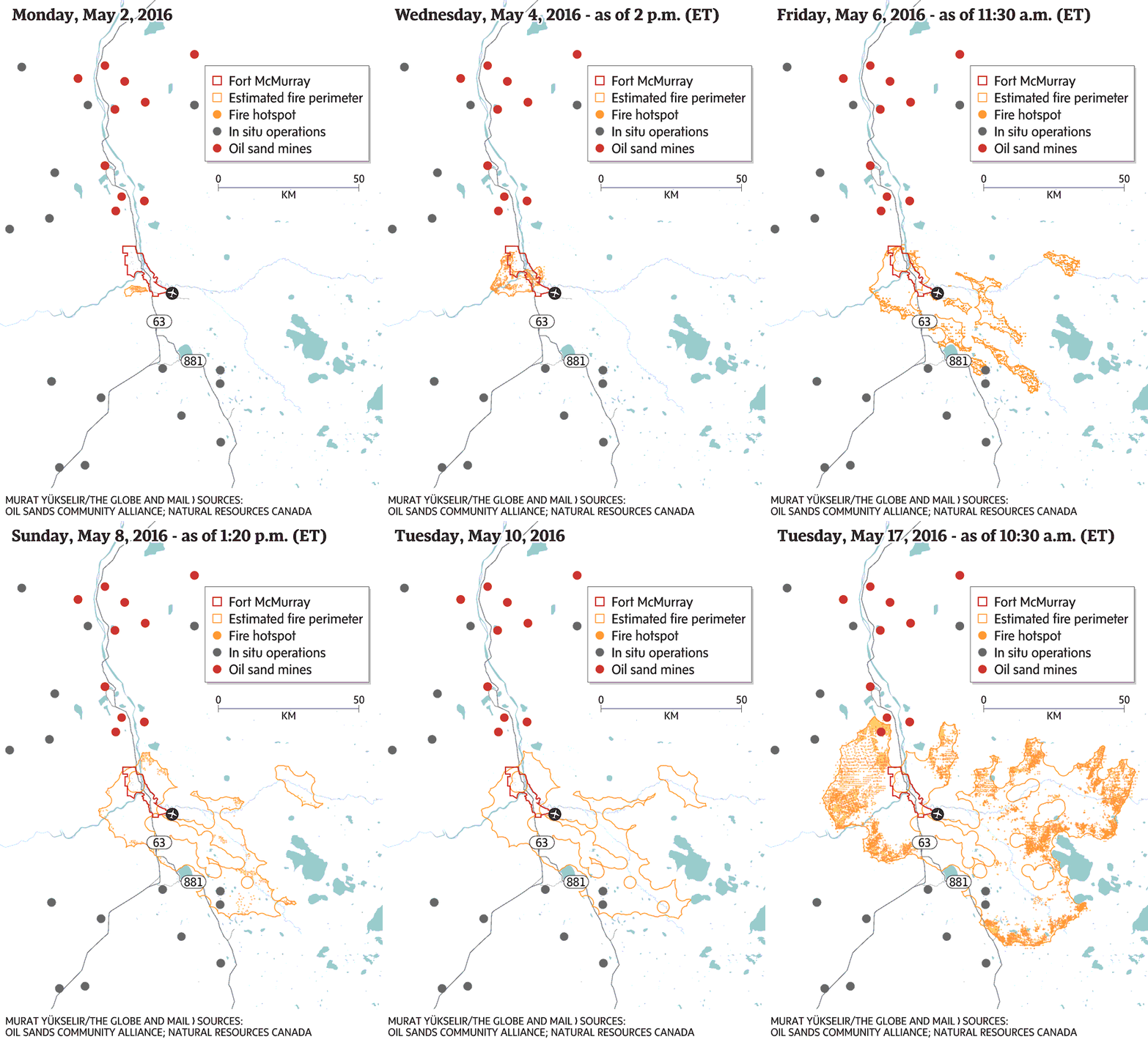
We have followed this event closely, and in this note, we summarise a list of Earth Observation agencies and companies who have made contributions by offering accessible satellite images. The list is by no means exhaustive but would cover an overwhelming majority. We hope this survey might be useful to someone who wishes to quickly gain an overview on this topic.
1 – A list of Earth Observation agencies and companies who contributed timely satellite imagery for the May 2016 Fort McMurray Wildfire
| Agency / company | Satellite | Resolution | Date | Useful links |
| NASA, USGS, NOAA | Landsat-7, Landsat-8 | 15m, 30m | 3-May-16; 4-May-16; 5-May-16; 12-May-16 | Link, Link, Link, Link, Link, Link |
| MODIS | 250m | 24-May-16 | Link, Link | |
| Suomi NPP | 375m, 750m | 16-May-16; 24-May-16 | Link, Link | |
| ESA | Sentinel-2A | 10m, 20m, 60m | 2-May-16; 5-May-16; 12-May-16 | Link |
| DigitalGlobe | WorldView-3, WorldView-2 | 0.3m, 0.5m | 5-May-2016 | Link |
| Airbus Defence & Space | Pléiades | 0.5m | 6-May-16 | Link, Link |
| SPOT-6, SPOT-7 | 1.5m | 6-May-16 | Link | |
| Google Terra Bella | TerraBella | ~1m | 5-May-16; 6-May-16; 12-May-16 | Link |
| UrtheCast | Deimos-2 | 1m, 4m | 6-May-16 | Link |
| Planet Labs | RapidEye | 5m | 6-May-16 | Link |
| 21AT and Earth-i Ltd | DMC3/TripleSat constellation | 1m, 4m | May-16 | Link |
It is apparent that private companies are providing high-resolution images acquired immediately after the fire penetrated into urban areas. Such images are very useful for assessing the damage to the built environment. Governmental agencies are offering medium-resolution images (e.g. Landsat and Sentinel-2) and low-resolution images (e.g. MODIS and Suomi NPP), which are essential for documenting the big picture of the event and the damage to the broad landscape.
2 – Sentinel-2 SWIR images
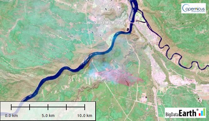
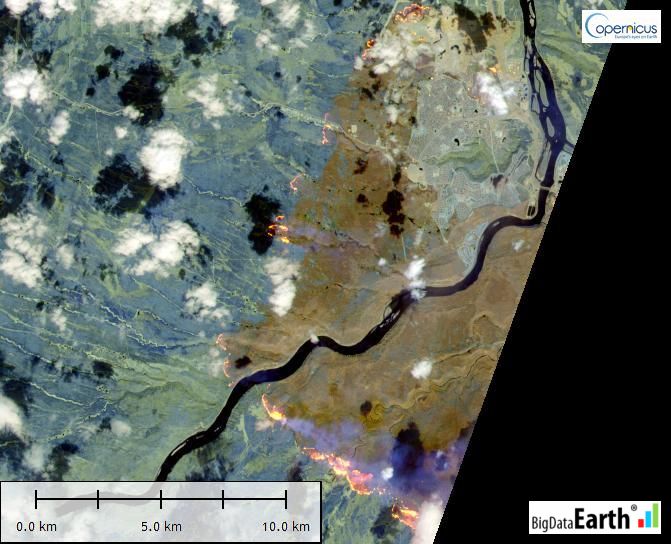
Here we also contribute uniquely-processed short-wave infrared (SWIR) images from the new Sentinel-2 satellite. Sentinel-2 images captured on three separate days in May indicate various stages of the fire, and each image is processed (with image fusion) at a sharp spatial resolution of 10m.
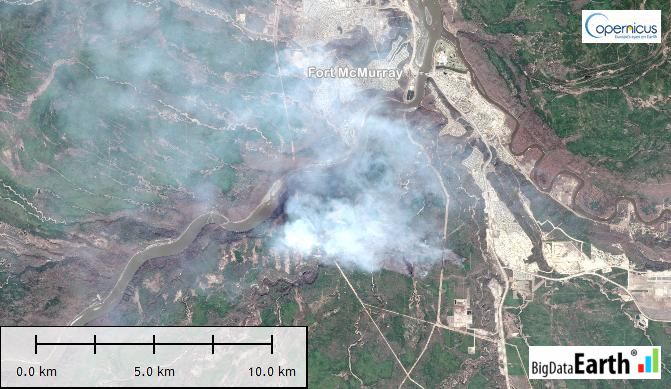
Figure 1: The May 2016 Fort McMurray Wildfire (image date: 2016-05-02). Very few images had captured the early stages of the fire, but this image clearly shows the fire began in southwest of Fort McMurray. Left: natural colour RGB composite; Right: SWIR composite.
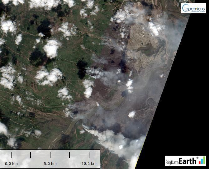
Figure 2: The May 2016 Fort McMurray Wildfire (image date: 2016-05-05, after the damage to the wildland-urban interface). Left: natural colour RGB composite; Right: SWIR composite.
Figure 3: The May 2016 Fort McMurray Wildfire (image date: 2016-05-12). This image shows the massive extent of fire scars for the Fort McMurray region, Alberta. Left: natural colour RGB composite; Right: SWIR composite.

