26 June 2017
Location information and insights are becoming ubiquitous and more important than ever. Tangible and easy-to-read location information, mainly through maps and various visualisation techniques, enhances our understanding of many dynamic phenomena.
For the current news reporting on major hazardous events taking place around the world, there is a need to include more detailed and coherent location information.
We take the 2017-06-24 landslide in SW China as an example, and have produced an exposure location profile report. The report contains relevant location-specific environmental metrics, including elevation, 3D terrain perspective, slope, contours and water flow directions.
It is hoped that such baseline information will provide more geographic context and enrich the news reporting on the event. We have been developing a cloud-based big data content and analytics platform (https://propertylocation360.com/) to make a contribution in this direction.
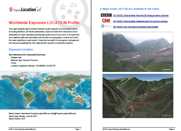
Figure 1: Exposure location profile report for the 2017-06-24 landslide in SW China. (Click the image above for PDF report)
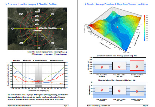
Figure 2: Typical location maps and metrics included in an exposure location profile report for major hazardous events.