Digital Earth for a Physical World – Geospatial Big Data Sources
Main Data Sources We Analyse
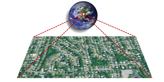
Digital Satellite and Aerial Imagery at All Spatial Resolutions
- Low- to medium-resolution satellite imagery (e.g. JMA Himawari 8/9, NOAA GOES 16/17, NASA/USGS MODIS and Landsat, Copernicus/ESA Sentinel)
- Medium- to high-resolution satellite imagery (e.g. 5m-resolution RapidEye, 1.5m-resolution SPOT 6/7)
- High-resolution satellite imagery (e.g. 30cm-resolution WorldView-3, 50cm-resolution Pléiades)
- Very high-resolution digital aerial imagery (e.g. 10cm resolution), including those captured by the new-generation drones/UAV/UAS
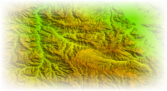
Digital Elevation Model and LiDAR Point Clouds
- Medium-resolution DEMs for a near-global coverage (e.g. NASA/USGS 90m- and 30m-resolution SRTM)
- Medium- to high-resolution elevation mosaic at the country level (e.g. 10m-resolution)
- High-resolution DEMs derived from satellite stereo pairs (e.g. 2m-resolution from WorldView-2)
- LiDAR point clouds, photogrammetric point clouds, including those from the recent drones/UAV/UAS captures
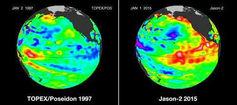
El Niño: 1997 vs. 2015 (Source: NASA JPL)
Climate and Weather
- Historical weather records across monitoring stations (e.g. usually from national meteorological agencies)
- Historical climate grids (e.g. typically derived from the time series of weather records)
- Climate cycles data (e.g. ENSO, Atlantic Multidecadal Oscillation – AMO, the Indian Ocean Dipole – IOD) and global/regional climate change forecast
- Data from the new generation of meteorological satellites (e.g. JMA Himawari-8 imagery with a high revisit frequency of minutes)
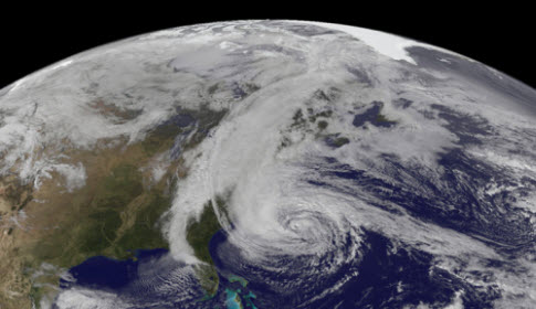
2012 Hurricane Sandy (Source: NASA EO, NASA LANCE)
Natural Hazards
- Near real-time monitoring and modelled data for tectonic and geologic hazards (e.g. earthquake and tsunami)
- Near real-time monitoring and modelled data for meteorological hazards (e.g. flood and cyclone)
- Near real-time social media communication data in response to major disasters worldwide
- Fresh Earth observation data in response to major disasters worldwide
Source: Google Maps
Street, Address, Land Parcel and Property Location
- Street networks
- Physical addresses and locations for residential, commercial and industrial assets
- Cadastre and land parcels
- Building footprints
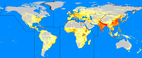
LandScan global population distribution (Source: ORNL)
Infrastructure, Population, Dwellings and other Census Stats
- Infrastructure (e.g. roads, railways, telecommunications, energy, utilities and drainage)
- Population, dwellings and other socioeconomic attributes from national census
- Hierarchical spatial digital boundaries used by national census
- Modelled ambient population distributions for lager areas
Others
- Land cover, land use
- Environmental pollution (e.g. air, water and soil)
- Business data (e.g. insurance portfolio and claims)
- Traffic flows
- …