27 March 2017

BigData Earth has been developing cloud-based solutions for delivering property (exposure) location profile reports, and one of these is for emergency and insurance applications (e.g. emergency planning and response, and insurance underwriting). For locations, addresses or sites in Australia, a national platform and web portal has been developed: https://propertylocation.com.au/georisk.html
Main features of this platform and related reports include:
-
A large, nationwide coverage.
-
The best open data (e.g. elevation and imagery) are sourced from government agencies. Especially, the elevation data from the Geoscience Australia’s ELVIS Elevation Information System are extensively explored.
-
The report is accessible and easy-to-understand. We have tried to include many relevant maps, graphs and charts to achieve this.
-
The report can be easily requested online across platforms from desktop computers to smart phones, either in-office or on-the-go. A Google Maps-based search interface is included.
-
The report contains a wide range of location metrics about the physical landscape, population and dwellings. (2016 Australian census data to be released in April 2017 will be included in regular updates.)
-
The report provides sufficient geographic context. In this regard, labelled high-resolution imagery (access via Google Maps API) is handy and an excellent source.
-
The report includes maps highlighting some important geomorphological and hydrological processes associated with certain hazardous phenomena.
-
The report uses many visual representations, which also help identify and evaluate the uncertainty associated with any geospatial input data.
-
As location information and insights become ubiquitous, the tangible location profile report can be highly useful when investigating natural hazards, and environmental, technological and man-made emergencies and disasters.
Currently, each location profile report (in PDF format) can be generated in 2 – 4 seconds. The whole platform is backed by two terabytes of processed geospatial data on the cloud.
Application example:
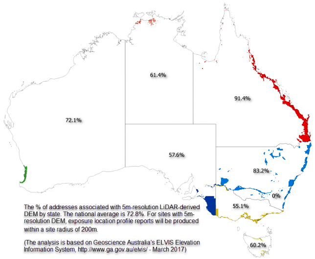
Figure 1: The platform is able to produce detailed location profile reports (within a site radius of 200m) for 72.8% national addresses, which are associated with 5m-resolution LiDAR-derived DEM.
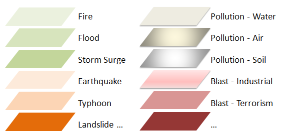
Figure 2: Location profile reports can be generated in relation to natural hazards, as well as environmental, technological and man-made emergencies and disasters.
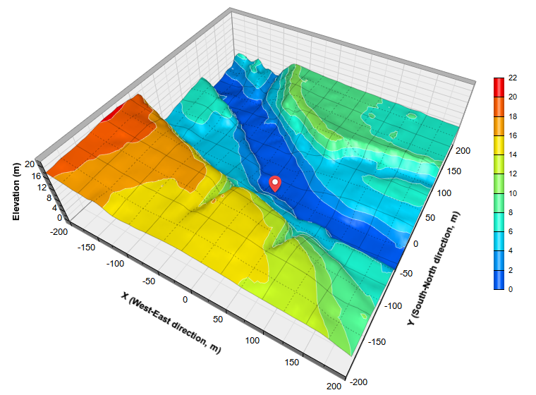
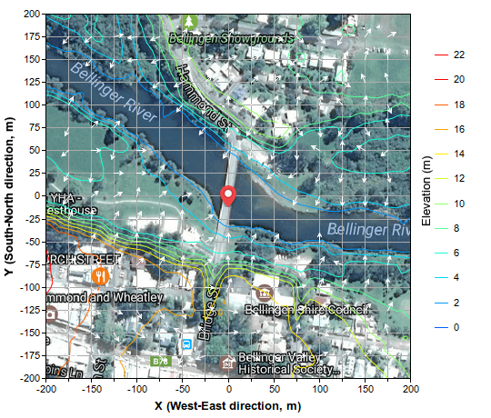
Figure 3: An example of maps included in the report highlighting important geo-processes and geographic context.